By Serena Shores
Prior to 1250, the town of King’s Lynn, in the right hand corner of East Anglia’s large square estuary, the Wash, sat at the head of the small Norfolk rivers Gay and Nar and was fed by several inlets or fleets, Purfleet forming the town’s harbour. The nearby rivers Ouse and Nene joined near Wisbech to the west and flowed into the sea from there.
Even at such an early stage in the life of the port, it was necessary for human hand to play a part in altering its natural features. Silting of the channel was becoming a problem so Well Creek was excavated, diverting the major rivers of the Nene and Ouse to King’s Lynn.
This was joined by other cuts to the north and east which allowed the Ouse to join the Little Ouse and Wissey, giving a more direct route for these now combined rivers to reach Kings Lynn.
All this endeavour came on the back of 12th Century cuts which made it easier for Ely and Cambridge to send corn by boat, as the population and agricultural activity increased in the broad expanse of fertile lands directly to the south of the town.
King’s Lynn was at a perfect advantage of being a natural outlet for trade and huge amounts of cargo including wool, hides, wine, fish and ale passed through the harbour. At this time the town’s main industry was the boiling of salt, which was exported. The great inland religious houses sent corn and wool to Europe, receiving in return vital supplies of timber and other building materials. Pitch and iron were imported from Scandinavia. Such was the town’s prosperity, that in 1203 King John decided to tax 15% on imports and exports.
The town was to remain in the very top of English ports for centuries because of its strategic location on the Wash. King’s Lynn and its ‘sister’ port of Boston were second only to London.
Merchant capitalists sailed their ships all over Europe and were in Lynn trading furs and wine for corn and fish. The Low Country trade in particular was vital for the wool merchants, with 2000 sacks per year leaving Lynn and also reaching the Baltic, Flanders and Gascony along with supplies of corn and ale.
By the 15th Century, trade with the Hanseatic League became very important for the town and a warehouse was built to accommodate this in 1475. Furs, beeswax, pitch, cloth and timer were exported and at this time Lynn also sent an annual fishing fleet to Iceland. Trade diversified and coastal traffic was crucial, but all too quickly greatly diminished by the competitive ‘lure’ of the port of London and shrinking wool exports.
The trade in wool continued to decline and by the 16th Century King’s Lynn was no longer a major international port. During this and the following century the main export was grain and iron, timber and pitch were imported. Of course, by then, like many eastern ports, it was suffering from the discovery of the Americas, which bought great prosperity to towns such as Liverpool. It did however retain a trade with Northern France, in 1600 sending cargoes of coal and cloth to Dieppe and Rouen in exchange for hops and millstones, the rock which was only found in France.
In the year 1604-5, 96 ships were entering and 159 leaving the port. Merchants returned to Iceland and broke the monopoly of chartered companies in London. Trade flourished with the Netherlands, Scandinavia, France and Spain.
It is noteworthy that by the late 17th Century, imports of wine from Spain, Portugal and France in exchange for wheat and barley and an increase in the coastal trade boosted King’s Lynn’s prospects. There was also coal coming down from the north. Also, the great scheme to drain the nearby Fens had begun, which brought with it a huge rise in the cultivation of wheat, so the export of farming products became vital to the port’s livelihood. The town had also developed as a substantial fishing port and shipbuilding, rope and sail making began to thrive.
Unfortunately, by now the River Ouse had grown too large and it simply wasn’t getting water to the sea quick enough, creating problems with navigation and flooding. Apart from the extensive draining of the Fens where onions, hemp, oilseed, peas and flax were grown, the 17th Century also saw projects such as a shortening of the Ouse and the construction of a very large sluice several miles inland at Denver (its impressive successor is still to be seen today) but this threatened Lynn as silt began dropping in the harbour and the Fenland water couldn’t escape.
Above Denver the river was very slow as there was no tide to push water upstream. Where seagoing ships had once freely sailed inland, during the summer, only small craft could navigate this part of the Ouse and cargo from the larger vessels had to be transferred to horse and cart at the sluice. There were several attempts to be rid of this obstacle and an accident of nature saw it demolished, but it was re-built in 1748.
Otherwise, generally speaking, navigational problems had been reduced in the 17th Century through inland improvements to the river system. Economic activity increased with the counties Lynn served and trade prospered, with the harbour now capable of taking 250 ships.
During the 18th Century, huge work was undertaken to repair the crumbling banks of the Ouse and clear the channels of the ‘fleets’ and new cranes and quays were built.
The Town Corporation improved the reliability of the pilots and new moorings, buoys and beacons helped make the channel safe. Trade from large ships increased in the harbour and were unloaded of their cargoes of coal, flour and salt by lighters as navigation to the sluice was by then so difficult.
The Corporation at this point sought advice on improving the Ouse navigation. Eau Brink Cut to St. German was completed to save time by removing the necessity of following the natural loop in the river and the channel was scoured in 1818. Within two years the faster flow of water had removed enough silt to make the Ouse several feet deeper, but mud was still being dumped in the East Harbour by the ebb tide. Larger ships couldn’t cope with the wide, shallow channel and unfortunately Lynn soon saw itself being overtaken by Hull.
In 1847, the railway arrived, which to a certain extent robbed the haven of much of its coastal and river traffic, but an estuary cut in 1853 was to help save the town as it changed the Great Ouse from again occupying a wide and shallow estuary with treacherous sand banks to a more navigable and efficient channel. This in conjunction with river improvements made access for larger ships possible for the first time. The success of this enterprise was consolidated by the building of two immensely important new docks, Alexandra Dock in 1869 and Bentinck Dock in 1883.
Even though road improvements meant that it was easier to take trade to London, many farmers still preferred the coastal transport system. Coastal trade increased, but the war with France damaged overseas exports. Trading corn to the north and south continued and extensive dealings with other parts of the country involved a vast array of commodities.
Unfortunately, though, a disastrous accident occurred when a steamer from Baltimore ran aground in the channel in 1889. The Wick Bay broke its back and the Corporation had to spend the enormous sum of £20,000 to remove it and save the future of the port.
This led to the creation of the King’s Lynn Conservancy Board to safeguard the river and Lynn approaches, becoming a pilotage authority and dealing with navigational aids and removing wrecks. Dredging also began in Alexandra Dock in 1876, because opening both sets of lock gates to allow in longer ships not only brought in the incoming tide, but also mud.
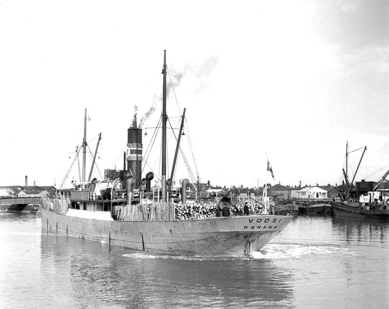
The following century visiting vessels included the Gwendolynne Birch (1920s), the Hochsee and Hallingdal in the 1930s, and Konny M, Caroline M and Veenenburgh in the 1950s.
The 1980s saw the visit of vessels such as the Poljola and by the 1990s Union Topaz could be seen loading grain. During the 1960s a purpose-built single grab dredger called Breckland was carrying out the task of clearing the channel. In 1981 this was replaced by Lenne Regis.

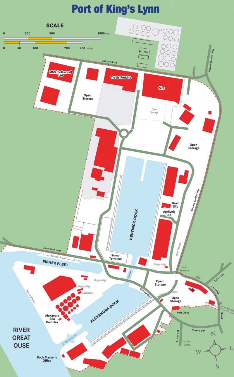
Lynn Docks were privatised in 1983 and taken over by Associated British Ports in the 1980s. They proposed the building of a new quay in 1988, royal assent was granted in 1990 and in 1991 Riverside Quay (situated between the lock entrance and Fisher Fleet) was completed. It could accept vessels of a 20 metre beam and 6 metre draught and cost £250,000, opening in 1992.
The port faced competition during the 1990s because of the increasing efficiency of Hull and saw the loss of not only the Hamburg Ro Ro in 1994 (because of the struggle to find sufficient cargo), but also the re-routing of car shipment by VW meant that Washbay lost its most important customer. However, the Czech car manufacturer Skoda and tractor manufacturers Setor were bringing vehicles in via Hamburg.
In 2000 ABP made a significant investment in Alexandra Dock by the building of a silo complex which could store 25,000 tonnes of grain. That year they also purchased a 35 tonne Liebherr harbour crane at a cost of £1,000,000 which was replaced in 2003 by a 25 tonne Liebherr and Fuchs excavator with a discharge of 250 tonnes.
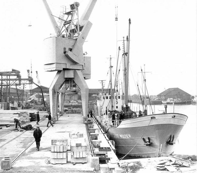
Today cranage comprises a 26 ton harbour crane and two Fuchs hydraulic grabbing excavators, a 25 tonne Stolhert at Bentinck Dock and a 20 tonne Smith Rodley at Alexandra. The travelling cranes have been scrapped.
The King’s Lynn Conservancy Board still operates from their offices built on Common Staithe Quay. As Kings Lynn is a trust port, the KLCB is self-financing, deriving income from port users and navigational buoys farther out in the Wash. The KLCB is responsible for conserving the river bed for navigation, removal of wrecks, towage, surveying the channel, provision of pilots and marking with buoys, lights and beacons, a service it has continued since 1913. In 2002 it was reconstituted under the Harbour Revision Order and its members reduced from 21 to 12.
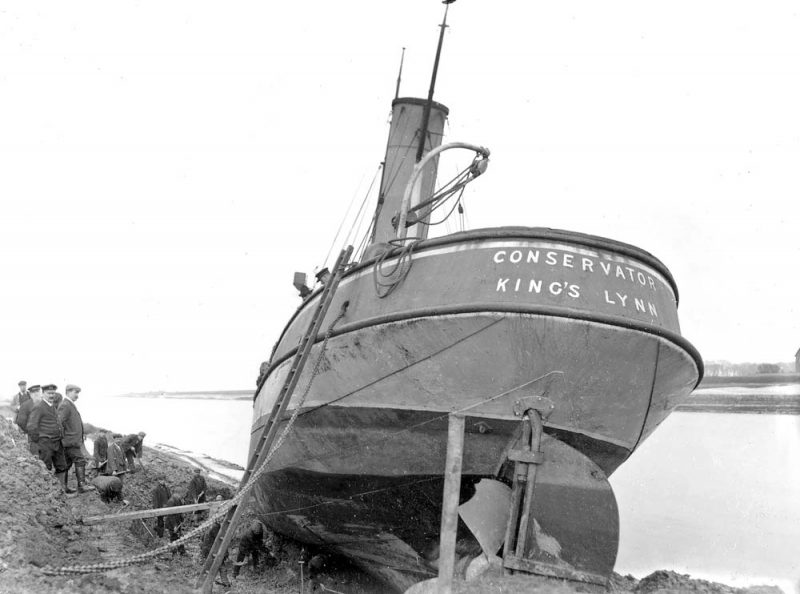
The KLCB owns and operates two fast pilot cutters, the St. Ann and United, which transfer pilots to ships in the Wash and the tug Conservator is there to assist large vessels. They also operate Staple-Wear and a buoy maintenance vessel the St. Edmunds. Depths in the river and channel approach are regularly measured due to rapid shifting sands in the area.
Total tonnage surpassed 1,000,000 for the first time in the years 1979-1983 and by 2010 throughput stood at 723,000 tonnes.
In 2011 a scheme between ABP and the Environment Agency saw the installation of a new set of mitre gates to guarantee flood protection. At a cost of £140,000, the gates are computerised and hydraulic rams lock them in place against the pressure of the water.
The commercial use of the harbour quays ceased in 2004, when Banks’ Cargill Agriculture closed down its South Quay grain silo and transferred operations to ABP’s Alexandra Dock.
South Quay is now used as a layby berth where berthed ships always sit on mud at low water. Vessels of 95m can berth at South Quay, but those of 140m length and 20m beam can be accommodated at ABP’s Riverside Quay with a maximum draught 6m on a spring tide.
Today the Port of Lynn remains one of England’s leading small ports, trading extensively with Europe, a business which is invaluable to the local community.
In 2014 the port handled 475,419 tonnes of cargo, brought in by 211 ships with a combined gross tonnage of 493,731. In 2015, it was 474,432 tonnes of cargo carried by 236 ships with a gross tonnage of 487,447. The main import was timber, with wheat and barley making up the bulk of exports, but fertiliser, rapeseed, woodchip, steel, sugar beet and soya also passed through the port.
Broken down, the activity in 2015 included eight vessels arriving in Lynn from Bonnieres with wheat and six ships from La Pallice bringing maize. The imported fertiliser came from the Baltic, Klaipeda in Lithuania and Police in Poland. Randers, on the east coast of Denmark sent six vessels carrying LECA (a building material). 15 vessels sailed back to the Baltic port of Oxelosund with woodchip for Stora Vika in Sweden to feed power stations.
There was also an interesting single cargo leaving Lynn for Gdansk comprising speedway sand.
Lynn’s principal exports remain barley seed and rapeseed which leave the Wash for Rotterdam, 46 ships doing so in the same year (being 2015). Amsterdam, Antwerp and Ghent are also destinations. A few vessels also took wheat and barley to Seville, Vila Garcia and Lisbon and cargoes of scrap metal went to Santander and Bilbao.
Coastal shipping remains significant for Lynn. One feature was the number of vessels which unloaded timber at Lynn having already unloaded part of their cargo at Seaham and Hull.
Lynn’s seaborn commerce also includes Scotland and Ireland. Vessels transport wheat and barley to Cork and animal feed to Ross in Eire.
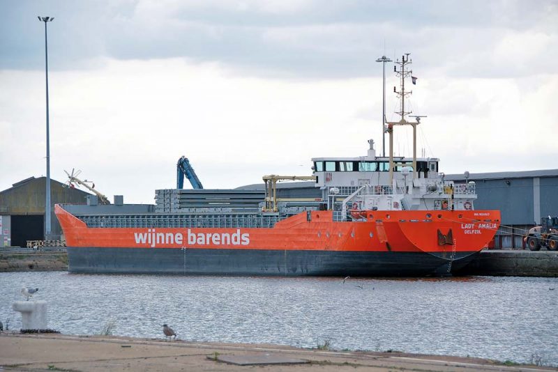
The history of the close relationship with the Scotland goes back to before it joined the UK in 1707, the Scots exchanging salt, fish and coal for cloth skins and beans. Coasters frequently carried coal from Kirkcaldy to the Wash. Today the ships travelling for Scotland, (11 for Buckie on the Moray Firth) mirror that coastal trade by carrying on the ancient and essential tradition of providing East Anglian barley to supply whisky production.
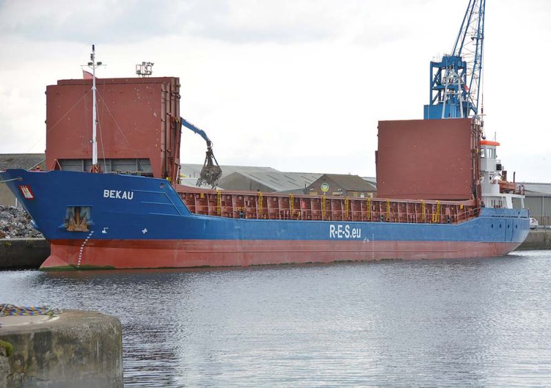
Examining port activity again in April 2016 reveals 23 visiting vessels. Lady Amalia from Gunness, arrived at Lynn on 7th in ballast and departed the next day to Oxelosund with woodchips. A cargo of scrap metal was taken by the Steinau from the Wash to Bayonne in France. On 22nd the Lady Anneke docked with a cargo of LECA and departed for Rotterdam in ballast. The Sky Vita from Gunness arrived in ballast on 10th then departed for Seville with wheat. A load of barley was carried by the Forseti destined for Hamburg and the Eagle left for the Moray Firth with one of those valuable barley supplies for the whisky industry.
The Wilson Lee also brought fertiliser to Lynn from Poland.
Wheat and barley from the Eastern Counties comprised most of Lynn’s export trade.
Today some vessels leave Lynn with the designation of Sea for Orders.
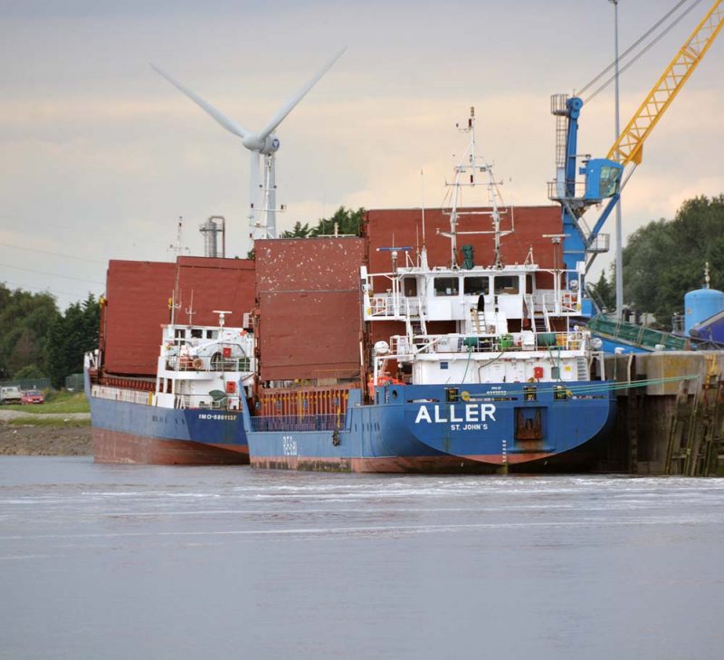
The Port of Lynn’s jurisdiction extends from Staplewear near Stowbridge seaward to the Wash, protecting colonies of wildfowl and seals and shellfish beds essential to the prospering of the Fisher Fleet which is still very much part of the town’s economy. The E-IFCA however is responsible for maritime conservation and policing fishery. ABP controls the two enclosed docks and Riverside Quay as well as Fisher Fleet.
Today Lynn’s Northern European trade is strongly tied to Sweden and the Low Countries but its historic links with Hanseatic ports of Hamburg, Lubeck, Kiel, Rostock, Gdansk and Riga remain very healthy. It is also a member of the New Hanseatic League of 185 ports, including Boston and Hull, the only British members. It is hoped that sea traffic between the Hanseatic ports could grow through this alliance and ABP and the KLCB are working together to expand the port’s trade and its links with the local community.
The Alexandra Grain Silo offers 25,000-tonne capacity alongside drying and screening facilities. There are dedicated bulk stores offering 23,000 capacity. The 97 acres offer a full range of terminal operations for both cargo shippers and receivers including haulage to a buyers’ yard, on-dock machining and services of transit stores. Facilities at Bentinck Dock exist for the storage and distribution of recycled metal and renewable energy products.
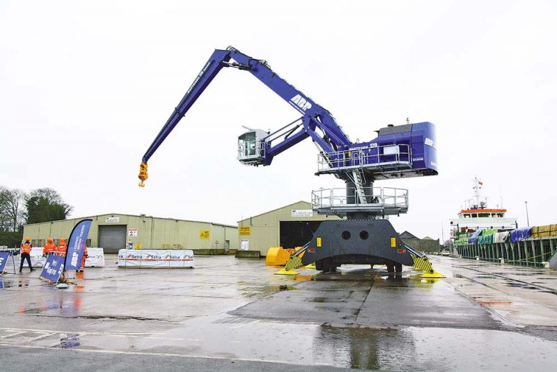
The Port of Lynn continues its relationship with many British and foreign ports and the announcement by ABP of a £3.3 million investment in the dock estate includes a new bulk warehouse capable of storing a wide range of commodities, which was completed in July 2017. ABP has also taken delivery of a new hydraulic Mantsinen crane from Finland at a cost of £1.1 million. This has a wider reach to allow larger vessels of up to 18 metres wide to use the Riverside Quay and provide customers with access to upgraded facilities and equipment which will drive efficiency across the port.



Comments
Sorry, comments are closed for this item